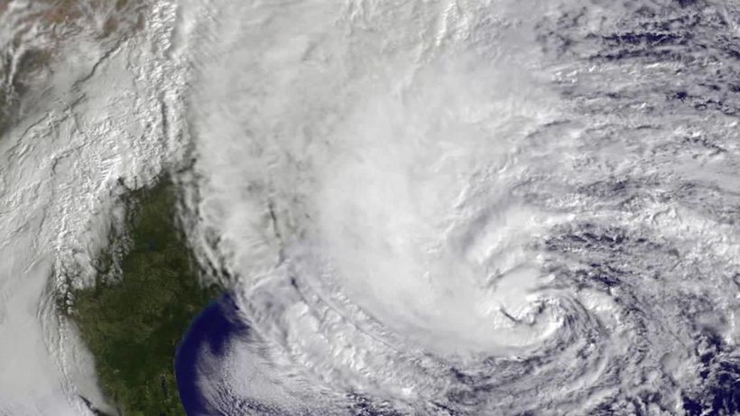


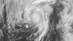
The 2020 Atlantic hurricane season will be “extremely active,” the National Oceanic and Atmospheric Administration said Thursday in its revised forecast.
The agency predicts 19 to 25 named storms in the season that began June 1. Of these, seven to 11 storms are predicted to become hurricanes, with three to six of those forecast to be major hurricanes of Category 3 or stronger. An average season produces 12 named storms.
The agency has never forecast up to 25 storms in a season, said Gerry Bell, lead seasonal hurricane forecaster at NOAA’s Climate Prediction Center.
“This year, we expect more, stronger and longer-lived storms than average, and our predicted ACE range extends well above NOAA’s threshold for an extremely active season,” Bell said.
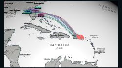
Stay updated with this season’s hurricanes and track individual storms here
NOAA warns that “now is the time to organize family plans and make necessary preparations,” basing its forecast on temperature and wind patterns, and an “enhanced west African monsoon.”
Colorado State University’s updated forecast, released Wednesday, concurs with the NOAA assessment. The CSU forecast calls for 24 named storms this season, including five of Category 3 or stronger. Nine named storms have already formed during the season, which ends November 30.
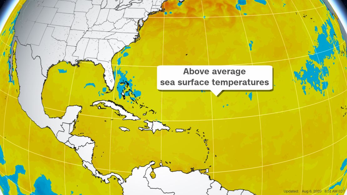
Water temperature and wind shear are in play
CSU’s revised forecast brings its predicted storm count up four from its expectation last month of 20 named storms and up eight from its earliest forecast of 16 on April 2.
“Overall, we increased the other forecast numbers because overall conditions look even more conducive than they did a few weeks ago,” says Phil Klotzbach, a CSU meteorologist who worked on the forecast.
This is the first time in CSU’s 36 years of predicting hurricanes that it has forecast 24 storms in its August report.
The forecast cites water temperature and wind shear as key indicators in predicting the strength of a hurricane season.
Warm ocean water temperatures in the Atlantic feed and strengthen hurricanes. Low vertical wind shear, the changing of wind speed and direction with height, keeps hurricanes tall and stable.
“Vertical wind shear is extremely critical for hurricanes in the Atlantic,” Klotzbach said. “Strong vertical wind shear, the change in wind direction with height, tears apart hurricanes and disrupts their intensification.”
Areas of low wind shear allow hurricanes to grow and intensify.
The forecast authors credit cool Pacific Ocean temperatures with the Atlantic season intensity, which could be part of the El Niño Southern Oscillation, or ENSO, a weather pattern that can predict a strong or weak Atlantic hurricane season.
“We believe that we will likely have either cool neutral ENSO or weak La Niña for the peak of the Atlantic hurricane season (August-October),” the forecast states. La Niña refers to a weather pattern of cold water in the Pacific and warm water in the Atlantic. It is generally correlated with a busy Atlantic hurricane season.
“We don’t necessarily need to have a La Niña event to support a very active season,” Klotzbach said. “We currently have cool neutral ENSO conditions, that is, colder than normal but not cold enough for the La Niña threshold.”
Even without meeting parameters for La Niña, colder temperatures in the Pacific contribute to the warmer Atlantic temperatures and lower wind shear that encourage hurricane formation.
This could be the busiest season yet
The 2020 season is already shaping up to rival the 2005 season, the busiest on record. Of the nine named storms this year, the third, fifth, sixth, seventh, eighth and ninth of the season have been the earliest of their number on record for any year.
Two of the strongest so far, Hanna and Isaias, both beat records for timing and caused major flooding and wind damage.

“On average, the season should only have two named storms by this time,” CNN Meteorologist Taylor Ward said. “But a season is about more than just the number of storms.”
“By the end of July, the 2005 season had already had two major hurricanes (Category 3+) make landfall, while both landfalls in 2020 so far have been Category 1 hurricanes,” he said.
Still, a hurricane does not have to be “major” to be dangerous.
“As is the case with all hurricane seasons, coastal residents are reminded that it only takes one hurricane making landfall to make it an active season for them,” write the CSU forecast’s authors. “They should prepare the same for every season, regardless of how much activity is predicted.”
Correction: A prior version of this story incorrectly stated when Colorado State University released its latest forecast. The update happened Wednesday.