India’s urban population went up from 17.9% in 1960 to 34.9% in 2020. Bengaluru’s population in the same time period increased more than 10 times. The city’s urbanisation has led to Bengaluru’s Land Surface Temperature (LST) increasing from 33.08℃ in 1992 to 41℃ in 2017 — a whopping 24% increase!
Researchers from the Indian Institute of Technology, Kharagpur have analysed Bengaluru’s urban expansion and how it affected surface temperatures. The study titled Analyzing and Predicting Urban Expansion and Its Effects on Surface Temperature for Two Indian Megacities: Bengaluru and Chennai also predicts the city’s urban area in 2025.
Key findings
- Bengaluru’s urban cover increased by 348% from 1992 to 2017.
- Area under vegetation reduced from 17.01% to 5.79%.
- Areas covered by water bodies reduced from 2.42% to 0.7%.
- Land surface temperature increased from 33.08℃ to 41℃.
Read more: Land surface temperatures in Chennai: Which areas have become hotter and why?
Unplanned urbanisation triggered by migration
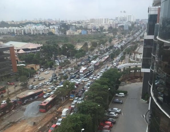
One of the researchers, Bharath H Aithal, described unplanned urbanisation in Bengaluru thus: After 2000, IT firms sprouted in places like Koramangala and Whitefield, thus expanding the area on a larger scale. This has led to increased real estate prices in such locations, making them unaffordable for those who migrate to Bengaluru for work. Thus these people started settling on the city’s outskirts beyond BBMP’s administrative boundaries. Also, BBMP has city development plans only for the area within its ambit, not for Bengaluru Urban or Rural.
Even inside BBMP limits, there have been some instances of uncontrolled growth. An IISc study surveyed 105 lakes and found that 98% of them have been encroached to build high-rise apartments and other complexes illegally.
Bengaluru has seen the population spurt both inside and outside the city limits. As per the 2011 Census of India, the population of the urban area of Bengaluru stands at 8.4 million as compared to the 2001 Census when the population was 5.7 million.
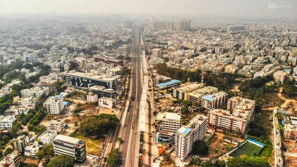
The extent of the urban cover has also increased over the years. The study cites that Bengaluru’s urban cover increased by 348% from 1992 to 2017.
Heat islands to climate change
Urban heat islands get created due to unplanned urbanisation. These islands/pockets are areas with closely spaced buildings and high population density. Heat gets trapped in these areas, especially between buildings, increasing the temperature.
“Land surface temperature (LST) is a proxy indicator of urban heat islands. LST is the skin temperature of the earth’s surface, which is normally more than the air temperature. If the land has been heated for a long time, then heat absorbed by the surface becomes high,” notes Aithal.
The LST also defines climate change in terms of greenhouse effect and global warming. Higher LST can be attributed to increasing human activities like transportation, construction, power generation, leading to higher pollution levels and emission of greenhouse gases.
For the study, LST was analysed from 1992 to 2017 for four land uses, using remote sensing technology.
- Urban – residential and industrial areas, paved surfaces and built-up areas;
- Vegetation – forests, croplands and nurseries;
- Water bodies – tanks, lakes, rivers and reservoirs;
- Others – rocks, quarry pits, open ground at building sites and unmetalled roads.
The study found that the urban land use class had increased from 5.47% in 1992 to 24.53% in 2017. This in turn spiked up the surface temperature from 33.08℃ to 41℃.
“There is no or less space around buildings these days. Also, the architecture of houses has changed. People want huge facades of glasses [in buildings]. India is in a tropical climate, hence heat has to be dissipated outside, and cool air should come inside. Using glass will trap heat,” says Aithal. He adds that this will increase the dependence on air-conditioners, releasing hot air outside along with carbon emissions.
The area under vegetation had reduced from 17.01% to 5.79%, because of urban expansion. The surface temperature of vegetative areas in 2017 was 38.78℃, from 31.10℃ in 1992. Currently, Bangalore Metro Rail Corporation Limited is building the Metro’s Outer Ring Road-Airport line at the expense of 5,000 trees, according to a recent report.
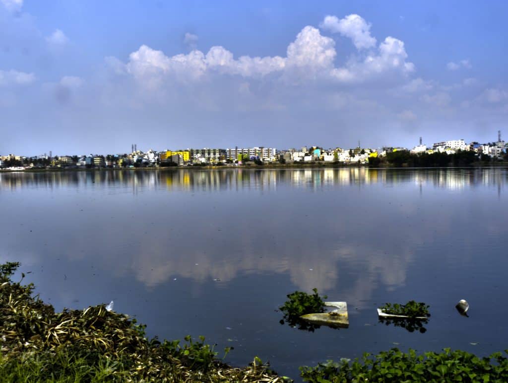
Water bodies also saw a dip from 2.42% to 0.7% of the area, with surface temperatures cranking up to 35.54℃ from 25.41℃.
“Historically, Bengaluru did not have a system of lakes. They [early inhabitants of the city] realised that the city was located at an appropriate altitude with a good climate, but it did not have any perennial water resources. This was when the lake system was developed from the river, with the patronage of Kempegowda I,” says R Saikamala, a conservation architect. Discharging untreated water into lakes was polluting the water bodies and increasing their temperature, she added.
Finally, the ‘Others’ category stood at 68.98% in 2017 from 75.1% of area in 1992, with temperatures increasing from 34.57℃ to 42.13℃.
Read more: PRR: Massive environmental damage for another futile Ring Road?
Hotter and cooler clusters
The study specified places with high and low surface temperatures for 2017. Jakkur airfield, Kempagowda International Airport, HAL Airport, goods loading terminal in Kadugodi, agricultural fields near Shankanipura, the dried-up Hesaraghatta lake, and few open areas showed the greatest surface temperatures, of between 44℃ to 51℃.
“Airports are densely built-up spaces. Air-conditioning and closed spaces trap heat. Also, they have runways that are built with a heat-sensitive material, indicating high temperatures in the region. There is little vegetation and few water bodies to absorb the heat and make the area cooler.
Areas with vegetation like Bengaluru Golf Course, Freedom Park and dense vegetation patches have moderate LSTs from 33℃ to 35℃. Waterbodies like Sankey Tank, Ulsoor lake, Bellandur lake also show lower temperatures around 30℃ to 33℃.
Dangers of high Land Surface Temperature
- The health of people can be affected by rising temperatures. According to World Health Organisation, high temperatures can cause cardiovascular and respiratory diseases. “LST studies can help in identifying the locations where the temperature has been rising at a higher pace. Thus, region-specific measures can be taken,” says Aithal.
- LST can affect agriculture and aquaculture. Higher temperatures can disrupt ecosystems, making it hard for organisms to survive in high temperatures. Unplanned urban expansion also impedes agriculture. “We should not construct in agricultural or fertile lands. It is hard to find lands with fertile soil,” says Saikamala.
- Rainfall patterns can be altered due to increasing surface temperatures. According to University Corporation for Atmospheric Research, higher temperatures may cause more evaporation and may produce higher rainfall, increasing the risk of floods. But Aithal also talks about another school of thought. He says that the warm air will be trapped by greenhouse gases and other pollutants without allowing it to go into the atmosphere and form clouds. Thus, there can be less rain too.
What can be done to reduce the temperature?
- Trees can be planted on the streets for shade. Plants can be used to construct entries to buildings to reduce LST and improve thermal comfort.
- Developing gardens and mini forests with native vegetation can cool down the microclimate.
- Water-sensitive urban design needs to be developed. Ponds, pools, fountains, hybrid systems like wind towers and sprinklers can be developed to cool the climate. Also, lakes must be maintained properly with no discharge of sewage or effluents.
- Introducing green roofs and using cool materials for construction can cool down interior temperatures.
Bengaluru’s urban growth
The study predicts that urban growth in Bengaluru will predominantly be within BBMP’s administrative limits, compared to outside the limits. Also, the city is said to expand in 2025, covering 1323.30 sq km, in contrast to 727.88 sq km in 2017.
While urbanisation is linked to economic growth, the city also needs to account for environmental sustainability. Will BBMP’s commitment to the Paris Agreement on climate change make a difference?
The lake system in Bengaluru is much older than Kempe Gowda. The inscription stones found around Bengaluru establish the age of many of the lakes at 1000 years or more..
The best way to solve all problems of Bangalore and other indian cities is to decongest them by dispersing business to undeveloped areas. This will decongest cities and bring development to backward areas. It will also help to prevent or minimise the dangers of epidemics and pandemics.